-

UK-wide support from local engineers
-

24/7/365 emergency callouts
-

Always one of the fastest to reach you
-

Friendly & approachable professionals
-

40 years of proven technical ability
Drain Mapping Experts
We have the experience and expert knowledge to carry out accurate, reliable drain mapping throughout the UK across construction, local authority, highways, manufacturing, facilities and property development sectors. Our drainage map service provides you with a high-quality drainage layout plan.
What is Drain Mapping?
Drain mapping, also known as asset mapping or a drainage layout plan, is a drainage service that uses GPS technology to accurately plot the location of various drainage features.
Using innovative technology, coupled with an extensive, national reputation for commercial excellence, we can plot the location of any pipes, manholes and gullies to produce a tailored bespoke drainage plan showing each element of your drainage system.
Drain mapping can also be used to determine the size, depth and directional flow of pipes within the drainage system, as well as identify which pipes carry foul water drains.
How Does Drain Mapping Work?
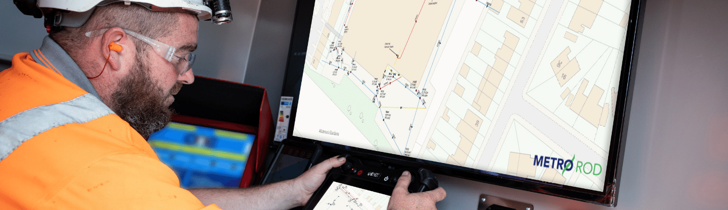
At Metro Rod, we’re known for our commitment to innovation and technology. To conduct a thorough drainage map survey, we use a cutting-edge GPS system which provides accuracy up to 2cm. We also work with coordinates, using OSGM15, to perform our drain mapping service.
Following the collection of the data, a report is produced to your exact specification and delivered quickly, showing you the drainage plan and information that you need the most.
Whilst on-site, our engineers work swiftly with minimal disruption to ensure you not only receive an accurate drain mapping survey but also the highest level of customer service.
What Does the Drain Mapping Report Include?
Drain mapping results in an in-depth drainage layout plan which can be tailored to your requirements. The report includes four key elements including:
- A site map with a schematic drawing of the drainage system
- An asset register detailing the location, size, access points and use of each drain section
- Manhole record cards showing images of each access point
- An interactive Google Maps overlay. Allowing you to click on each drain section and see the corresponding granular details and photos.
We can also provide you with a DXF file which can be imported to your existing CAD system and used with an OS tile background if required.
As well as drainage elements, we can create bespoke data collection forms to also map streetlights, park benches and other external items to meet your requirements.
Contact Us
Why Consider Drainage Mapping?
A drain map is a valuable planning and site management tool across a wide variety of industries.
- Drain mapping is a vital tool when planning pollution prevention measures and flood risk management. By knowing the layout of the drains, it is possible to plan a fast response in the case of a chemical spill, fire or other emergencies.
- For some commercial sites, such as COMAH (Control of Major Accident Hazards) and EPR (Environmental Permitting Regulations) regulated sites, drain mapping is part of the site compliance. We can help you ensure your drain map is fully compliant with any legal requirements.
- Typically, a drainage layout plan is a required service before any form of building project goes ahead. Conducting drain mapping safeguards against causing damage to any pre-existing drainage systems that may be costly to repair later down the line.
Experts in Drain and Asset Mapping
At Metro Rod, we are experts in drainage maps and drainage layout plans. Our highly trained engineers have the experience and knowledge to not only map the drainage system but fully understand your requirements and advise on the condition. We know how important it is to accurately map a drainage system and that is the reason we have developed a service built around our customer’s needs.
Find your local Metro Rod drain mapping specialist, or call us on 0800 66 88 00. We are always happy to arrange a free site visit and a no-obligation quote for any drain mapping work you might need.